HOMER Pro 3.15

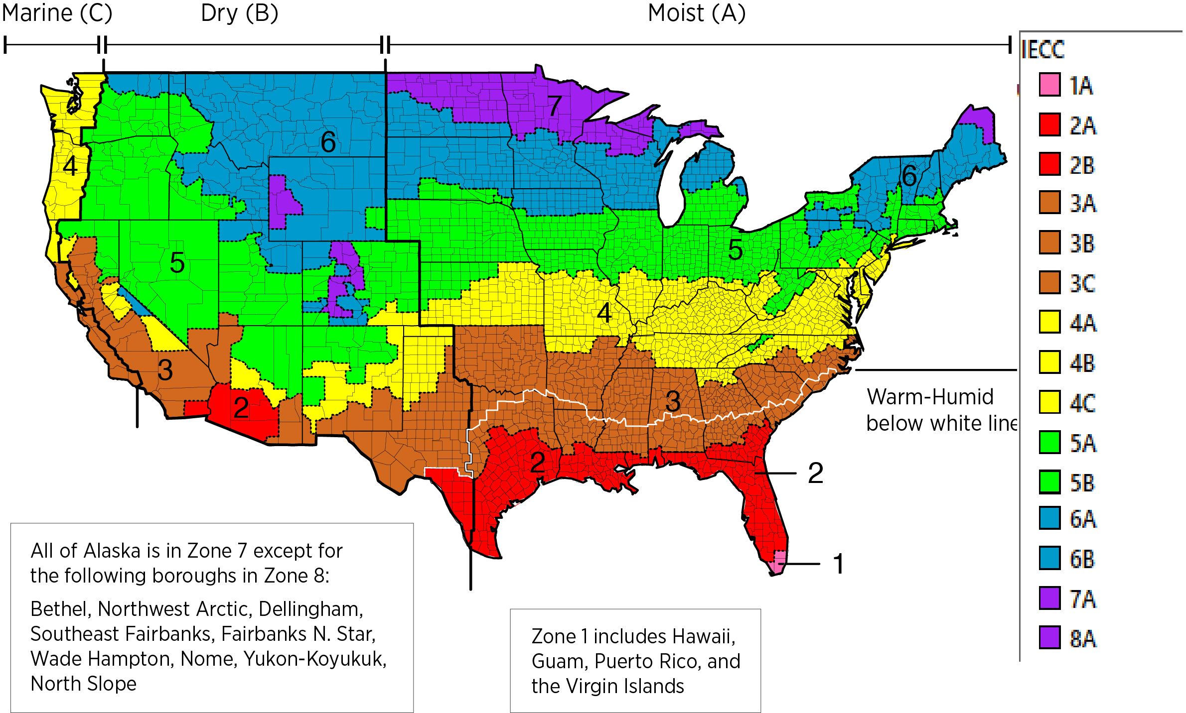
A Climate Zone Map can be found in the 2012 International Energy Conservation Code (IECC), funded by the U.S. Department of Energy- Energy Efficiency and Renewable Energy.
For each county in the United States, the IECC defines a climate zone.

Image Source: https://basc.pnnl.gov/system/files_force/images/IECCmap_Revised.jpg?download=1
Locations set within the US will be matched with the closest available location in the OpenEI database with the same climate zone.
The colors of the drop-down menu for climate zones corresponds to the colors in the image above.
The letters following the numerical climate zone correspond to:
|
A |
Moist |
|
B |
Dry |
|
C |
Marine |
For more details on how climate zones are defined: https://up.codes/viewer/nevada/iecc-2012/chapter/CE_3/ce-general-requirements#C301.3 Or, another resource for viewing IECC climate zones:
https://energycode.pnl.gov/EnergyCodeReqs/index.jsp
See also
Koeppen Gieger Climate Classification System
